|
|
|
The trip
|
|
Brenda and all of us . Jaime's picture, of course |
|||
Guadalupe, the BOSS. |
||||
Click on the image for a full size view |
The whole trip : From Johannesburg to Victoria Falls, across South Africa, Namibia and North Botswana, for a grand total of almost 7000 Km. (At last, everything included, even the micro light flight, 6952 Km. can be computed) Click here to download the whole route for Google Earth:
Party, party, party ... in Kalahari |
|||
Namib Dessert
Namib overflight. Click on the image for a full size view |
Click here to download the overflight route for Google Earth: |
|
Dune from the plane. Click on the image for a full size view |
|
Quads track. Click on the image for a full size view |
Quads and girls.
Google Earth image showing the Quads track ( Swakopmund, Namibia). Click here to download the raid route for Google Earth: |
Etosha
Track from Okaukejo to Namutoni. Click on the image for a full size view |
Etosha National Park. From the Anderson Gate (Okaukejo) to the Von Lindquist Gate (Namutoni). In white, the immense Etosha Pan. Click here to download the game drives route for Google Earth: |
|
The big Pan .Click on the image for a full size view |
Absolutely flat lonely. The Pan is as big as Euskadi an there is nothing inside... |
Lion. Click on the image for a full size view |
Lots of animals in Etosha.....
|
Okavango Delta
|
Click on the image for a full size view |
Jean Claude, our Mokoro Poler.
Speed Boat along one of the Okavango channels. |
|||
Click on the image for a full size view |
The Okavango Ride Google Earth image with the route of our ride trough the delta:
Click here to download the Okavango raid route for Google Earth: |
|||
Click on the image for a full size view |
The eagle gets the meat and... falls down to water... |
|||
Chobe
Crocodile is looking us. Click on the image for a full size view |
|
|
Click on the image for a full size view |
Chobe National Park. Plane landing and boat ride trough Chobe river. Click here to download the boat game ride route for Google Earth: |
Elephant, Moon, Venus & Jupiter . Click on the image for a full size view |
|
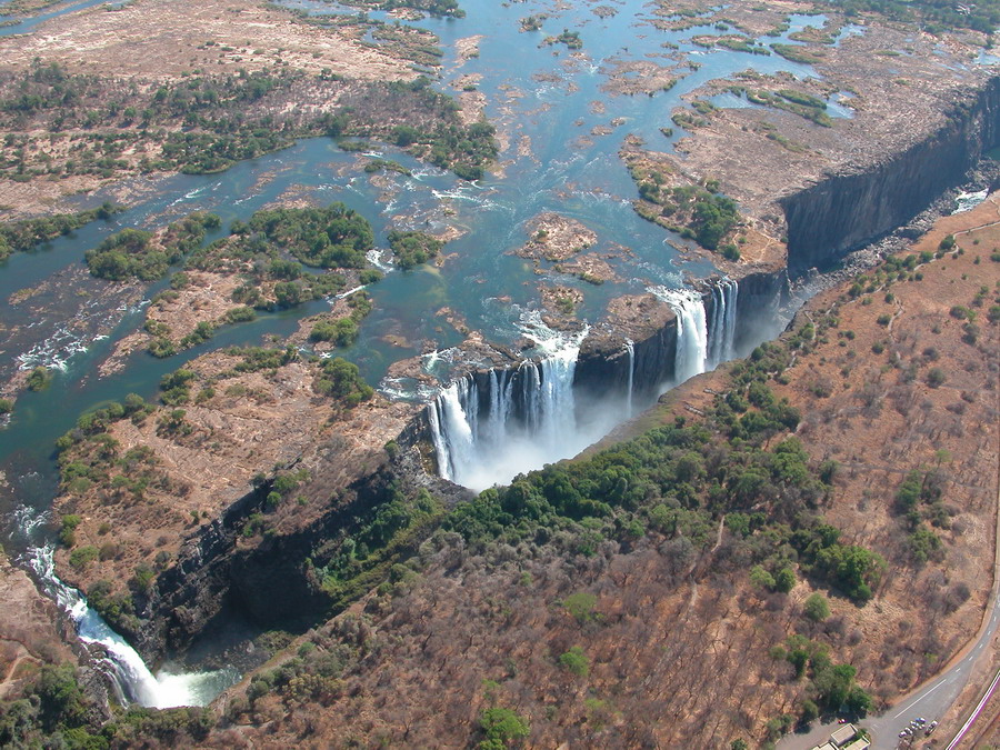
Victoria Falls
|
Click on the image for a full size view |
Flying over Victoria Falls
Rainbow from Zimbawe |
|||
Click on the image for a full size view |
The Micro light flight
Google Earth image with showing the micro light track over Victoria Falls Click here to download the Victoria falls overflight route for Google Earth: |
|||
Click on the image for a full size view |
Victoria Falls from the sky . |
|||
 |
 |
More pictures : |
|
 |
Updated 11/11/2008